
- Makes it easy to determine the extent of land contaminated with radioactive poisons from wars
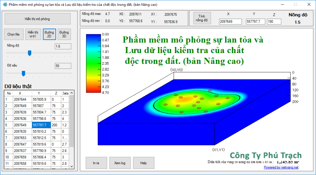
- Using 2D and 3D models to simulate soil contamination at what level?
- Provide sampled data.
- Simulate all data with 2D and 3D images.
- Quickly and accurately.
- Currently used in Nghe An province, Vietnam.